|
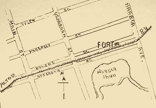 |
Map of Harbor Pond
Circa 1902 |
This map shows the streets still in place today near the location of where Harbor Pond used to be. The Artillary Company of Massachusetts built the fort, also known as the 1702 Garrisson, shown here. Garrisons were very popular during the Indian War periods as they were used for safe harbor from attacks.
|
|
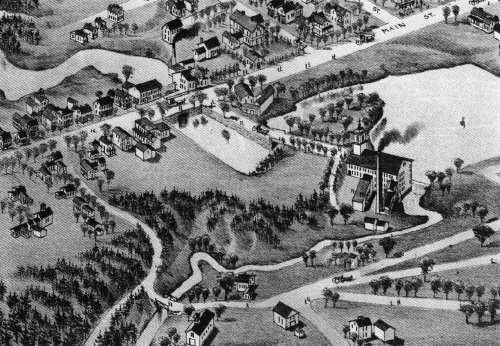 |
| Date forthcoming |
Here is another view of Harbor Pond looking west from the east side. The large road in the back portion of the sketch is Main Street.
|
|
|  |
|
|